Get County Estimates of Farmland Loss
go.ncsu.edu/readext?939932
en Español / em Português
El inglés es el idioma de control de esta página. En la medida en que haya algún conflicto entre la traducción al inglés y la traducción, el inglés prevalece.
Al hacer clic en el enlace de traducción se activa un servicio de traducción gratuito para convertir la página al español. Al igual que con cualquier traducción por Internet, la conversión no es sensible al contexto y puede que no traduzca el texto en su significado original. NC State Extension no garantiza la exactitud del texto traducido. Por favor, tenga en cuenta que algunas aplicaciones y/o servicios pueden no funcionar como se espera cuando se traducen.
Português
Inglês é o idioma de controle desta página. Na medida que haja algum conflito entre o texto original em Inglês e a tradução, o Inglês prevalece.
Ao clicar no link de tradução, um serviço gratuito de tradução será ativado para converter a página para o Português. Como em qualquer tradução pela internet, a conversão não é sensivel ao contexto e pode não ocorrer a tradução para o significado orginal. O serviço de Extensão da Carolina do Norte (NC State Extension) não garante a exatidão do texto traduzido. Por favor, observe que algumas funções ou serviços podem não funcionar como esperado após a tradução.
English
English is the controlling language of this page. To the extent there is any conflict between the English text and the translation, English controls.
Clicking on the translation link activates a free translation service to convert the page to Spanish. As with any Internet translation, the conversion is not context-sensitive and may not translate the text to its original meaning. NC State Extension does not guarantee the accuracy of the translated text. Please note that some applications and/or services may not function as expected when translated.
Collapse ▲North Carolinians love the phrase – Murphy to Manteo – to describe their beloved state that spans the Coastal Plain, Piedmont, and Mountain physiographic regions and all the associated ecosystems. North Carolina is blessed with a broad range of agricultural growing environments and it grows major row crops like corn, wheat, and soybeans as well as hundreds of horticultural crops including vegetables, fruits, berries, and landscape plants on 5,947,713 acres in its 100 counties from Cherokee to Currituck!
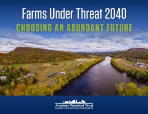
But by 2040, that acreage will be reduced to 4,750,413, a loss of 1,197,300 acres, if estimates are correct in a recent report by American Farmland Trust (AFT), Farms Under Threat 2040: Choosing an Abundant Future. The report also shares information on the location and quality of agricultural land, the threats posed by development, and policies that can help protect farmland and ranchland. This first-of-its-kind assessment was created to inform farmers, citizens, and policymakers on strategies to protect the agricultural land base.
We invite you to explore the information presented here and then take action by advocating for farms and farmers in your county or region. North Carolina estimates for farmland loss are ranked 2nd in the whole United States, just behind Texas. Loss is estimated to be ~1.2 million acres under the ‘Business as Usual’ development scenario. The reports shares how that can be reduced by the ‘Better Built Cities’ development scenario. North Carolina Future Scenarios of Farmland Loss How to Get County Information
Farmland Loss by NC County
Get county data to share with your local community, elected officials, or for a school report by going to Farms Under Threat 2040 Web Mapping Tool and State Summaries. You will see a short pop up introduction to the website. Read it and then scroll down and click ‘close’. Then Zoom in on the map to the state of North Carolina and click in your county of interest. You will see your county specific data on the right. Scroll down to see the proportion and acreage of the county’s best ag land that will be converted under the ‘Business as Usual’ scenario.
Policy Scorecard The Agricultural Land Protection (ALP) Scorecard is a state-by-state analysis of policies and programs that address the loss of farmland to development. Intended to inform decision-making and legislative action, it assesses state actions, measures their performance, and highlights effective aspects of the following programs and policies:
Purchase of agricultural conservation easement programs (PACE)
Land use planning and growth management
Property tax relief for agricultural land
Agricultural district programs
Farm Link programs
State leasing programs
North Carolina Agricultural Land Protection Scorecard Highlight Summary


